|
Nahe River - a
Western Tributary in the Rhine River Valley
This modern map of the Nahe River Valley shows the close proximity
of the villages were the Meÿ men and their wives lived over
a period of two hundred years. Off the map the Nahe flows to
the northeast, past Bad Kreuznach, and enters the Rhine
at Bingen - about fifteen miles from Niederhausen an
der Nahe. Our first family records come from Miesenheim,
where the Meÿs attended church while living in nearby Callbach.
The next set of records are from Alsenz and the last records
are from the church at Niederhausen an der Nahe.
<======= The width of this
map is less than nine miles ======>
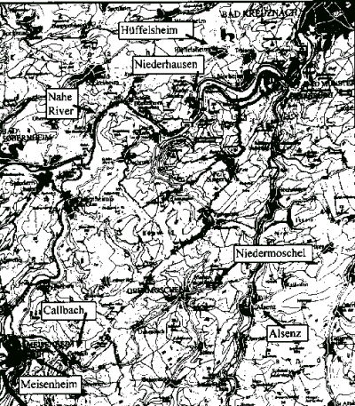
A modern-day map of the Nahe Valley showing the
home villages of the Meÿ families.
Point to a region
near the villages to select a detailed map
or select below for:
|
Return to Index of Spouse Essays or Home
Page
© 2000 Fred T. May
|