|
return to Mayhouse Home Page 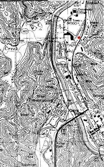 |
|
The original May farm of about 300 acres is located in the upper-right of this map, directly north of downtown Prestonsburg. The Samuel May House is marked in red. The May Cemetery is located on a nearby ridge northeast of the house. Buildings on the north end of the old farm now house Prestonsburg Community College. The Big Sandy River flows north through the town and the bridge across it in the lower right is the end of the Mountain Parkway from Central Kentucky. Abbott Creek flows into the Big Sandy River across from the farm which is intersected by Mays Branch. |